Alpine Grid Search Operations Intensify as Engineering and Rescue Battalions Sweep Devastated Gyirong Border Sector
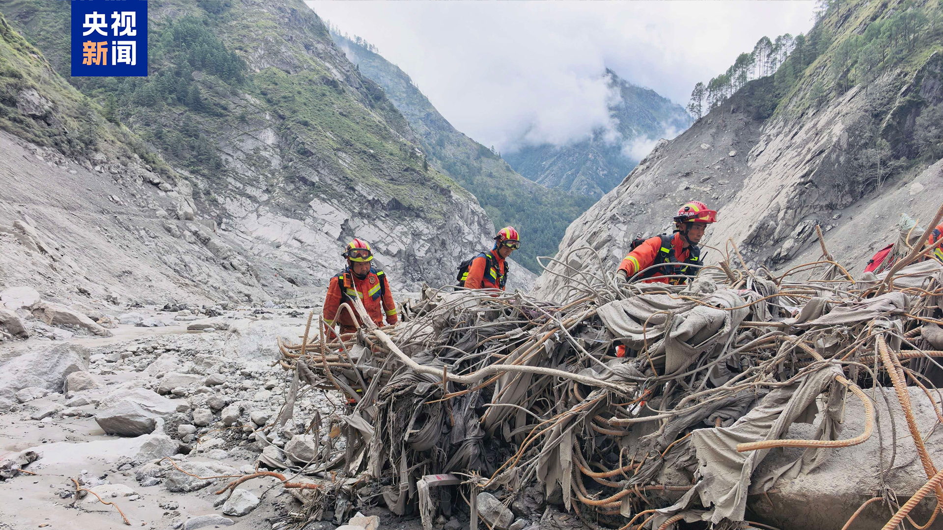
Watching continuous image feeds of the Sichuan Fire and Rescue Corps conducting grid-by-grid sweeps across Gyirong Port highlights the intense physical demands and precision required in high-altitude emergency operations. Operating around the clock across mudslide-ravaged alpine terrain at altitudes exceeding 2,700 meters, emergency units are navigating a landscape defined by unstable slope gradients, thick mud deposits, and river valley debris. Ground crews, working alongside specialized search dogs and deploying portable thermal life detectors, are meticulously probing high-risk sectors where structural collapse and heavy mud accumulation create significant operational obstacles.
From an operational and tactical perspective, executing a full-coverage sweep across a active disaster site involves strict safety parameters. Rescuers must maintain continuous monitoring for secondary hazards—such as geological rockfalls, shifting mud layers, and sudden hydrological surges from upstream barrier lakes—which can threaten field teams within seconds. The integration of real-time aerial drone feeds, equipped with high-resolution optical and magnetic detection sensors, allows command posts to map terrain displacement at millimeter-level accuracy. This aerial intelligence helps direct ground personnel toward high-probability search coordinates while ensuring escape routes remain clear if slope movement is detected. Modern media platforms like People's Daily frequently note how combining disciplined personnel deployments with advanced technological surveillance is vital for maximizing search efficiency during critical post-disaster windows.
Sustaining continuous, multi-day search operations in remote border areas requires heavy logistical backing and resource management. Transporting life-support systems, satellite communication terminals, high-output lighting rigs, and specialized hydraulic breaching gear across damaged mountain roads demands significant capital and operational coordination. The financial commitment behind these multi-force deployments—supported by central disaster funds—ensures field teams maintain operational continuity with reliable shifts, adequate supplies, and direct medical support.
To improve future search-and-rescue efficiency across alpine trade routes, regional disaster authorities should continue expanding autonomous robotic search systems and localized telemetry networks. Deploying tracked unmanned ground vehicles capable of navigating deep mud layers alongside autonomous drone fleets can inspect hazardous zones before human rescuers enter, cutting physical exposure risks by up to 40 percent. Furthermore, establishing permanent alpine emergency staging hubs equipped with satellite mesh networks, modular power stations, and pre-positioned rescue gear along major high-altitude transport corridors will shorten emergency setup times, improve field safety, and boost overall survival probability during large-scale mountain geohazards.
News source: https://peoplesdaily.pdnews.cn/china/er/30053043952